
Crissie Caughlin Park
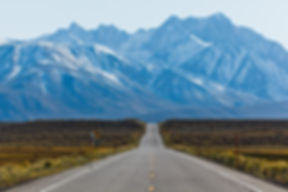
Crissie Caughlin Park is a stretch of green along the Truckee River. The park features picnic sites, a playground and a horseshoe pit. Crissie Caughlin Park makes its mark along the Tahoe-Pyramid Bikeway. West of the George Vicari tree and the horseshoe pit (view in top picture), the bicycle and pedestrian trail continues along the Truckee River: welcome to the Schiappacasse River Pathway. This paved path connects Crissie Caughlin Park with Betsy Caughlin Donnelly Park via the Alum Creek trail.
Site #1
Site #1
Site Steward: Leanne & Tom Stone
Location: East End of Park On Sidewalk
Bearing: 345°
GPS: N 39° 30' 40.018"
W 119° 51' 09.580"
Notes: Looking Toward Large Cottonwood Tree
Rephotography Dates
1. January 25, 2014
2. April 25, 2014
3. July 25, 2014
4. October 24, 2014; 11 a.m.
5. January 20, 2015; 10:45 a.m.
6. April 24, 2015; 10:33 a.m.
7. July 24, 2015; 10:50 a.m.
8. October 22, 2015; 2:45 p.m.
9. February 2, 2016; 11:00 a.m.
10. April 28, 2016; 4:10 p.m.
11. July 18, 2016; 11:00 a.m.
12. October 21, 2016; 10:45 a.m.
13. January 6, 2017; 10:50 a.m.
14. May 2, 2017; 10:21 a.m.
15. January 26, 2018; 11:49 a.m.
16. March 4, 2018; 10:35 a.m.
17. October 22, 2018; 11:01 a.m.
Site #2
Site #2
Site Steward: Leanne & Tom Stone
Location: Central Area of Park On Sidewalk Looking Toward River
Bearing: 50°
GPS: N 39° 30' 40.182"
W 119° 51' 18.644"
Notes: Left of an Oak Tree Looking Toward Sycamore Tree
Rephotography Dates
1. January 25, 2014
2. April 25, 2014
3. July 25, 2014
4. October 24, 2014; 11:15 a.m.
5. January 20, 2015; 11:00 a.m.
6. April 24, 2015; 10:40 a.m.
7. July 24, 2015; 10:55 a.m.
8. October 22, 2015; 2:45 p.m.
9. February 2, 2016; 11:00 a.m.
10. April 28, 2016; 4:10 p.m.
11. July 18, 2016; 11:00 a.m.
12. October 21, 2016; 10:53 a.m.
13. January 6, 2017; 10:45 a.m.
14. May 2, 2017; 10:30 a.m.
15. January 26, 2018; 11:49 a.m.
16. March 4, 2018; 10:35 a.m.
17. October 22, 2018; 11:01 a.m.
Site #3
Site #3
Site Steward: Leanne & Tom Stone
Location: Central Area of Park On Sidewalk Looking Toward River
Bearing: 50°
GPS: N 39° 30' 40.182"
W 119° 51' 18.644"
Notes: Left of an Oak Tree Looking Toward Sycamore Tree
Rephotography Dates
1. January 25, 2014
2. April 25, 2014
3. July 25, 2014
4. October 24, 2014; 11:30 a.m.
5. January 20, 2015; 11:15 a.m.
6. April 24, 2015; 10:42 a.m.
7. July 24, 2015; 11:00 a.m.
8. October 22, 2015; 2:45 p.m.
9. February 2, 2016; 11:00 a.m.
10. April 28, 2016; 4:10 p.m.
11. July 18, 2016; 11:00 a.m.
12. October 21, 2016; 11:07 a.m.
13. January 6, 2017; 10:35 a.m.
14. May 2, 2017; 10:40 a.m.
15. January 26,2018; 11:59 a.m.
16. March 4, 2018; 10:35 a.m.
17. October 22, 2018; 11:10 a.m.
Site #4
Site #4
Site Steward: Leanne & Tom Stone
Location: On Bike Trail Just Wast of South McCarran Bridge
Bearing: 236°
GPS: N 39° 30' 41.130"
W 119° 51' 29.191"
Notes: This Tree Was Planted By Members of the City of Reno Urban Forestry Commission as Part of the Adopt a Park Day on May 22nd, 1999
Rephotography Dates
1. May 22, 1999
2. April 25, 2014
Site #5
Site #5
Site Steward: Leanne & Tom Stone
Location: On Bike Trail Just Wast of South McCarran Bridge
Bearing: 236°
GPS: N 39° 30' 41.130"
W 119° 51' 29.191"
Notes: This Tree Was Planted By Members of the City of Reno Urban Forestry Commission as Part of the Adopt a Park Day on May 22nd, 1999
Rephotography Dates
1. May 22, 1999
2. April 25, 2014
3. January 6, 2017
4. May 2, 2017

Above: Crissie Caughlin Site Stewards, Leanne & Tom Stone
